

Crown Mountain hike via Hanes Valley – North Vancouver
Crown Mountain hike via Hanes Valley – North Vancouver
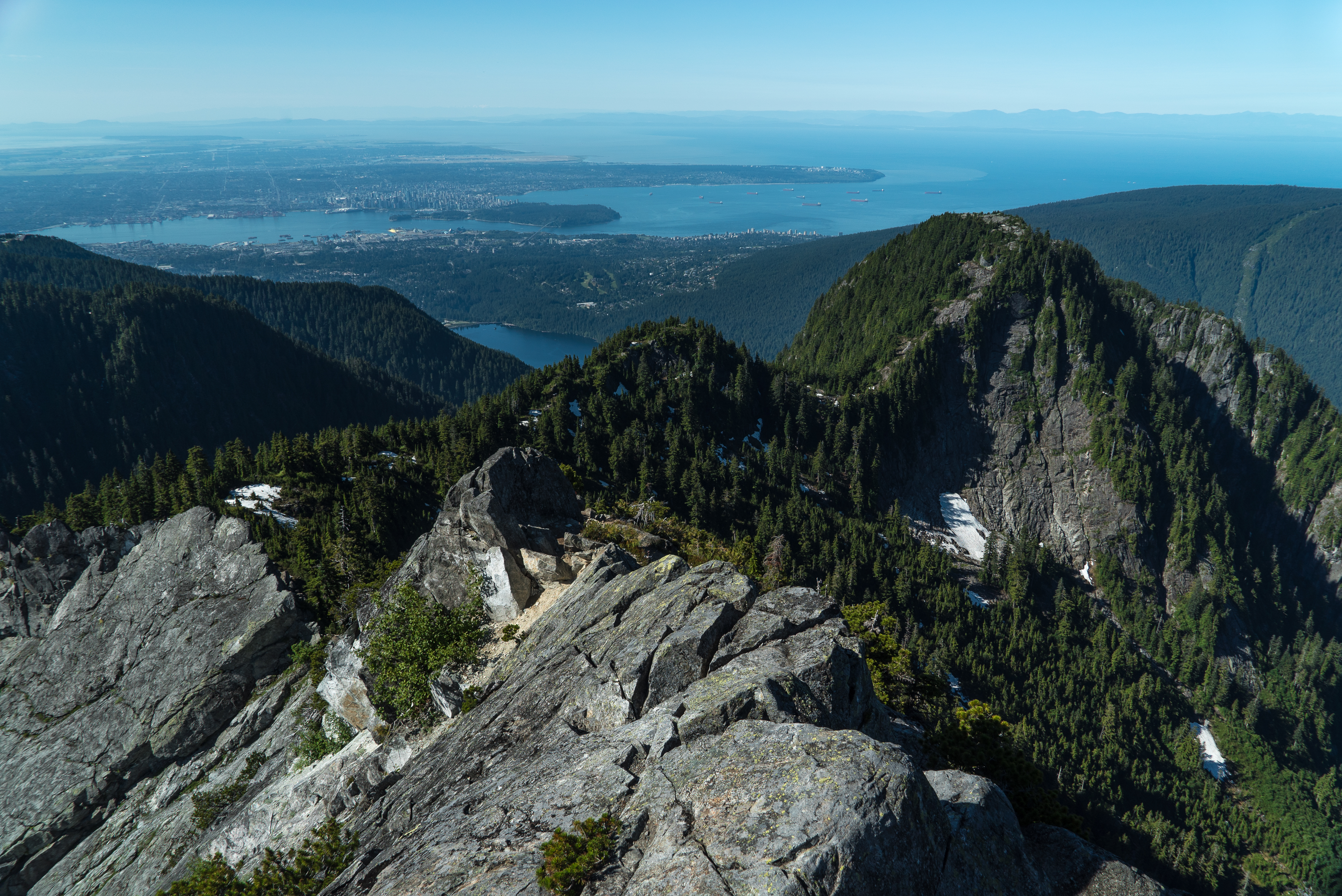
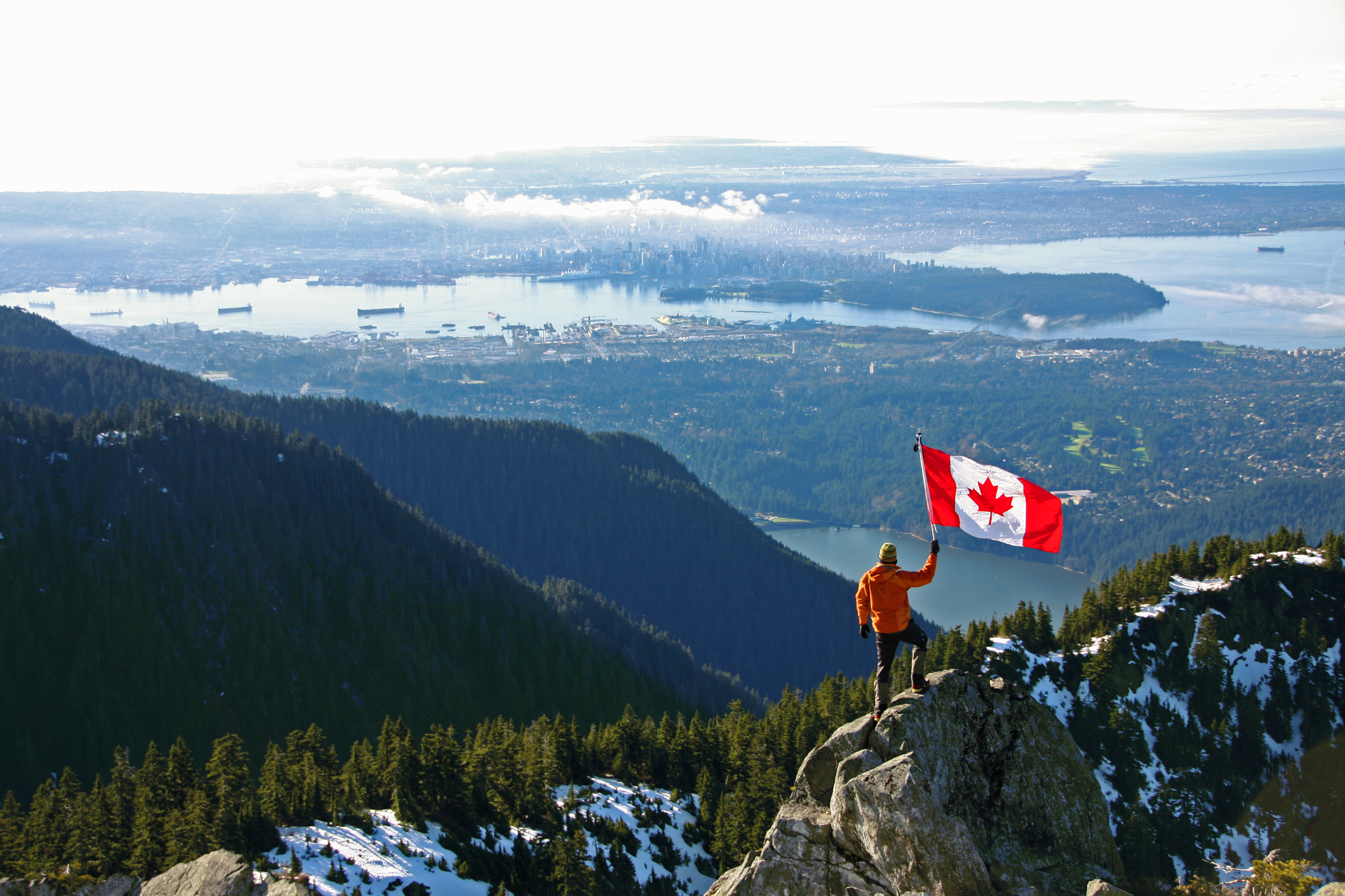
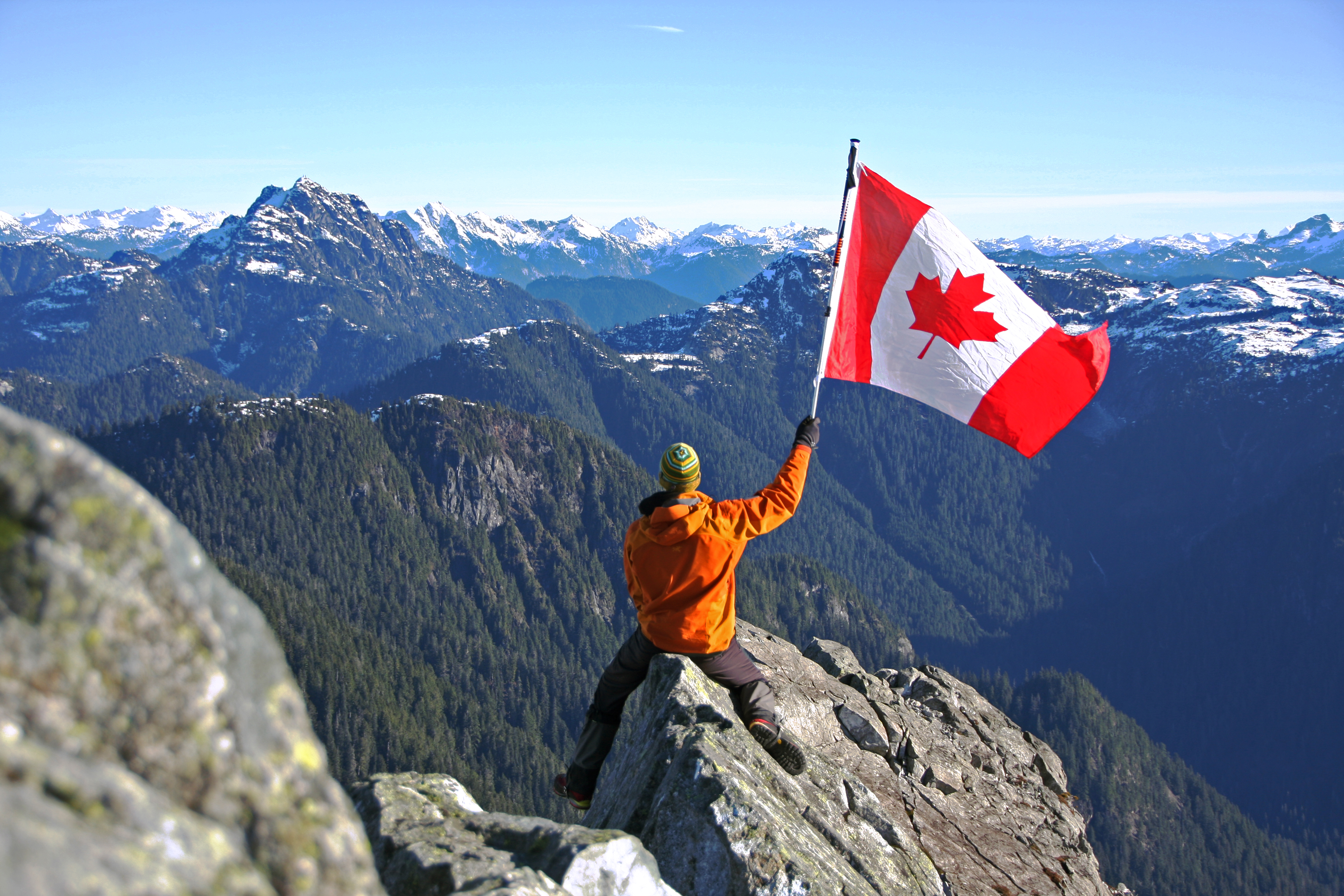
Crown Mountain hike is very challenging if reached from Lynn Headwaters, perhaps consider hiking it from Grouse Mountain. Crown Mountain, visible from downtown Vancouver towering above Grouse Mountain, was originally named 150 years ago due to its crown like shape. This challenging hike, recommended only to the experienced hiker, offers phenomenal views of the vast Greater Vancouver Area and far beyond the Canadian border to the south as well as beautifully deep within the North Shore Mountains. Crown’s sharp peak 1,504 m (4,935 ft) above sea level is a pleasure to stand upon, although extreme caution is necessary as any mistake can be deadly.
Distance (One Way): 14.5 km
Difficulty: Difficult // Long, steep and moderately difficult once ascending boulder field, dangerous climbing to reach summit
Season: June to October
Elevation: 1,504 m (4,935 ft) Gain: 1,300 m
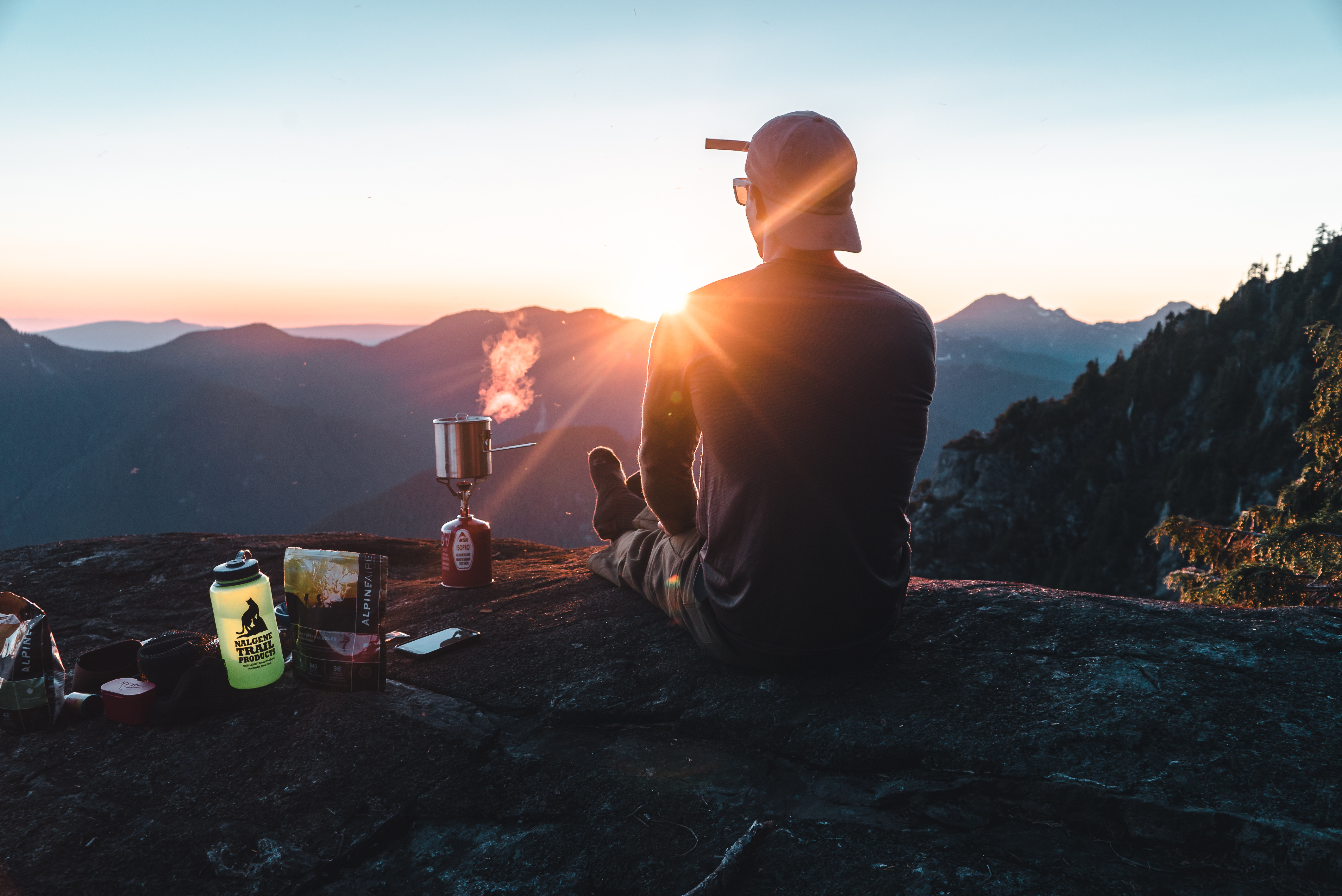
Scenery: ★★★★★
 Camping: No
From Vancouver: 40 minutes
Public Transit: Yes (click here to plan route)
Dog Friendly: No (too technical)
At about 40 minutes from downtown Vancouver, Lynn Headwaters is a very popular location for hiking, picnicking or swimming. Parking is limited within the park, therefor you may have to park along the residential roads of Lynn Valley. Beware of parking time limitation, many streets allow for 2 hours of parking only. This may also add a couple KMs to your trek.
Crown Mountain hike starts in the vast Lynn Headwaters Regional Park and follows Lynn Creek roughly 7km to Norvan Fall, a lovely waterfall perfect to take a snack break. Past the trail leading to the falls, one must continue onto the metal suspension bridge across Norvan Creek and enter the Lynn Headwaters backcountry. Keep in mind that the backcountry its only accessible within the summer months, opening as late a mid July depending on snow melt. Lookout for a sign after the bridge indicating if it is open or not. From here walk amongst old growth for 1km where you will encounter a map; take a left down towards Lynn Creek.
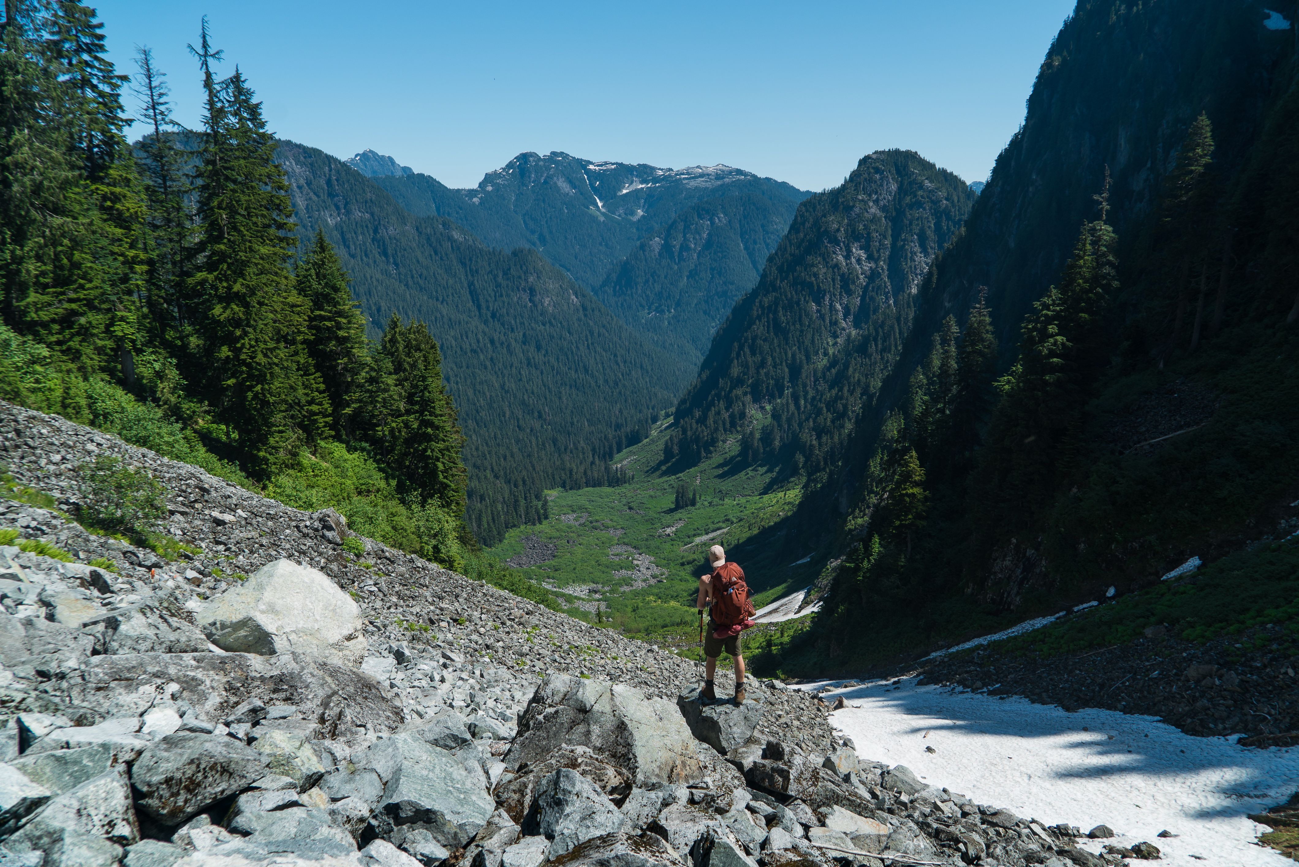
Once down by the creek, you will have to cross over to the otherwise by manoeuvre over a series of logs. Follow the yellow diamond markers for 2.5 km through more old growth and across (most likely dry) river beds. The view will start to open top and you will reach the base of Hanes Valley. Here you will find a heli pad and a barrel where the North Shore Search and Rescue team stocks gear to facilitate their rescues. Continue right where you will pass a little creek, a good place to refill on water if you have a water purification device. Continue into the trees and you will start to enter the boulder field. Be sure to follow the orange markers and signs of trail as you do not want to head up in the wrong direction. The trail carries across the boulder field and up once you hit a ties of bushes. This whole section is extremely strenuous and tiring especially under the hot sun as there will be no shade until you reach the top of Hanes Pass. Continue up the trail slow and steady, minding every step, as the uneven and unbalanced ground is unforgiving. Congrats you've made it up the steep boulder field, but, the battle is not over yet.
Follow the signs leading right heading up to Crown Mountain. The terrain will suddenly become very steep once again and can be super slippery depending on the conditions. Use the roots along the trail to secure yourself as you ascend. There will be a few sections of scrambling where you will have to climb up and across rock faces. Follow the spray painted dots along the rock face as it will lead you up the safest route. You will have to cross a river which may be snowed over depending on the time of the year, be very careful upon crossing as the snow is hollow not far beneath your feet. If there is running water, this will be the last water source until your return. Do not forget tp purify/filter the water for safe drinking. Continue up the steep mountain trail until you will reach an opening on the ridge and get finally get a view of the summit. You're almost there! Follow the trail to one last steep section that will start to reveal absolutely stunning views all around. Continue up at your own risk onto the spine to the summit of Crown Mountain and stick within your comfort zone. Enjoy 360 views that will leave you in awe for years to come.
There are many alternate hikes within Lynn Headwaters Regional Park, many more casual such as Norvan Falls, Rice Lake, Lynn Peak and other challenging hikes such as Lynn Lake, Coliseum and more.


 DOG FRIENDLY ON THE CROWN MOUNTAIN HIKE: NO