

St Mark’s Summit – Cypress Provincial Park


St Mark’s Summit – Cypress Provincial Park – West Vancouver
St Mark’s Summit in Cypress Provincial Park is a popular destination amongst locals as the well-maintained trail provides easy access to the Cypress Mountain Range in West Vancouver and offers phenomenal views over the Howe Sound.
A perfect day hike for those seeking a semi challenging adventure in lush nature not too far from the city with a very photogenic viewpoint to reward yourself at the end. The 11 km hike takes about 5 hours to complete and starts from the Cypress Mountain parking area.
Distance (Round-Trip): 11 km
Difficulty: Intermediate
Season: July to October
Elevation: 1,371 m (4,498 ft) Gain: 460 m
Scenery: ★★★★★
 Camping: Yes
From Vancouver: 45 minutes
Public Transit: No
Dog Friendly: Yes (on-leash)
Once you've found parking, head towards the Cypress Mountain lodge past the parking lot. If you plan to hike overnight, ensure to park in the designated overnight parking area, or you vehicle will be towed at your expense. Walk past the lodge and you will see a map board to the right. We recommend that you take a picture of the map with your phone to refer to later if needed. Confirm that you are carrying all of the hiking essentials and continue right to the gravel trail veering left into the trees. Almost immediately, you will reach a junction, you can take either route as they both connect further.
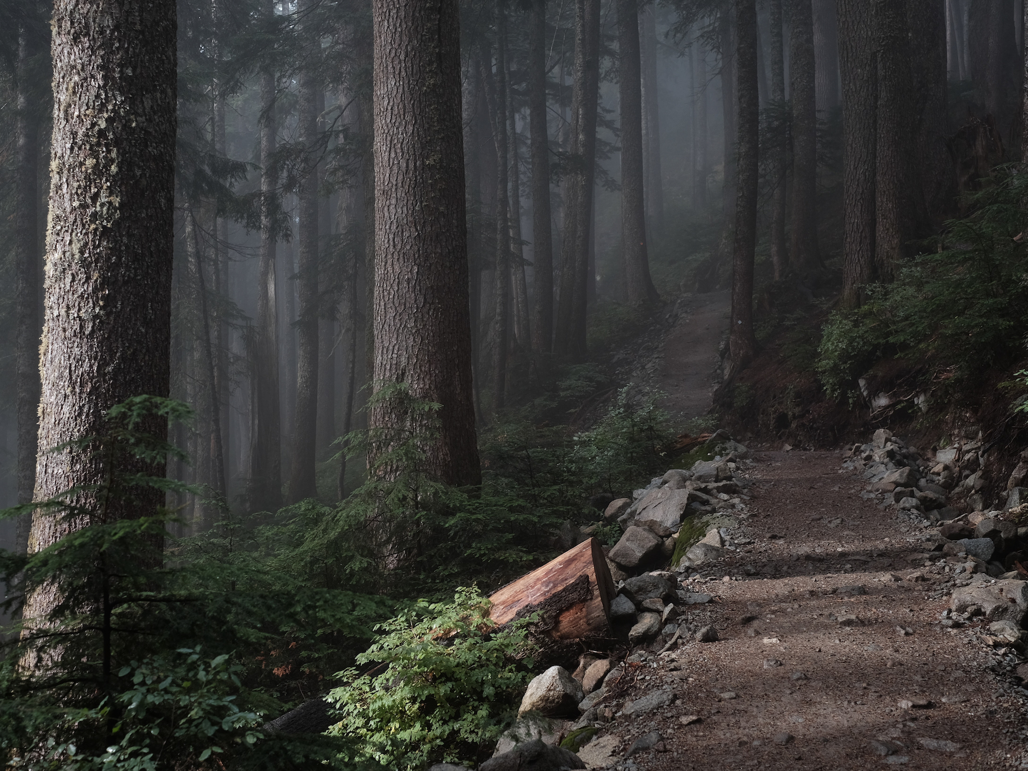
Follow the signs leading to the Bowen Lookout up the small switchbacks until you reach a trail junction, the trail veering left going to the Bowen Lookout and the other continuing along the Howe Sound Crest Trail, this is the route you want to take. Soon after, at about 1.6 km into the hike, you will reach a 'T' in the trail where a map board is located. Take a left here and follow the trail which will lead downhill along the mountain side. Roughly 1 km later, you will pass a small wooden bridge taking you over Montizambert Creek, continue this way on the well-maintained trail which will head up the mountain via numerous switchbacks.
The wide gravel trail will eventually lead back into more technical terrain with lots of roots and rocks around km 3 of the hike. Mind your steps and continue up along the trail. You will reach a ridge offering partial views through the trees, a little teaser before reaching the top. Take advance to catch your breath on this flat section as you are getting near the last and most difficult section of the hike. The trail will quickly become much steeper and technical but hang in there as you are getting close to the St Mark's Summit Viewpoint.
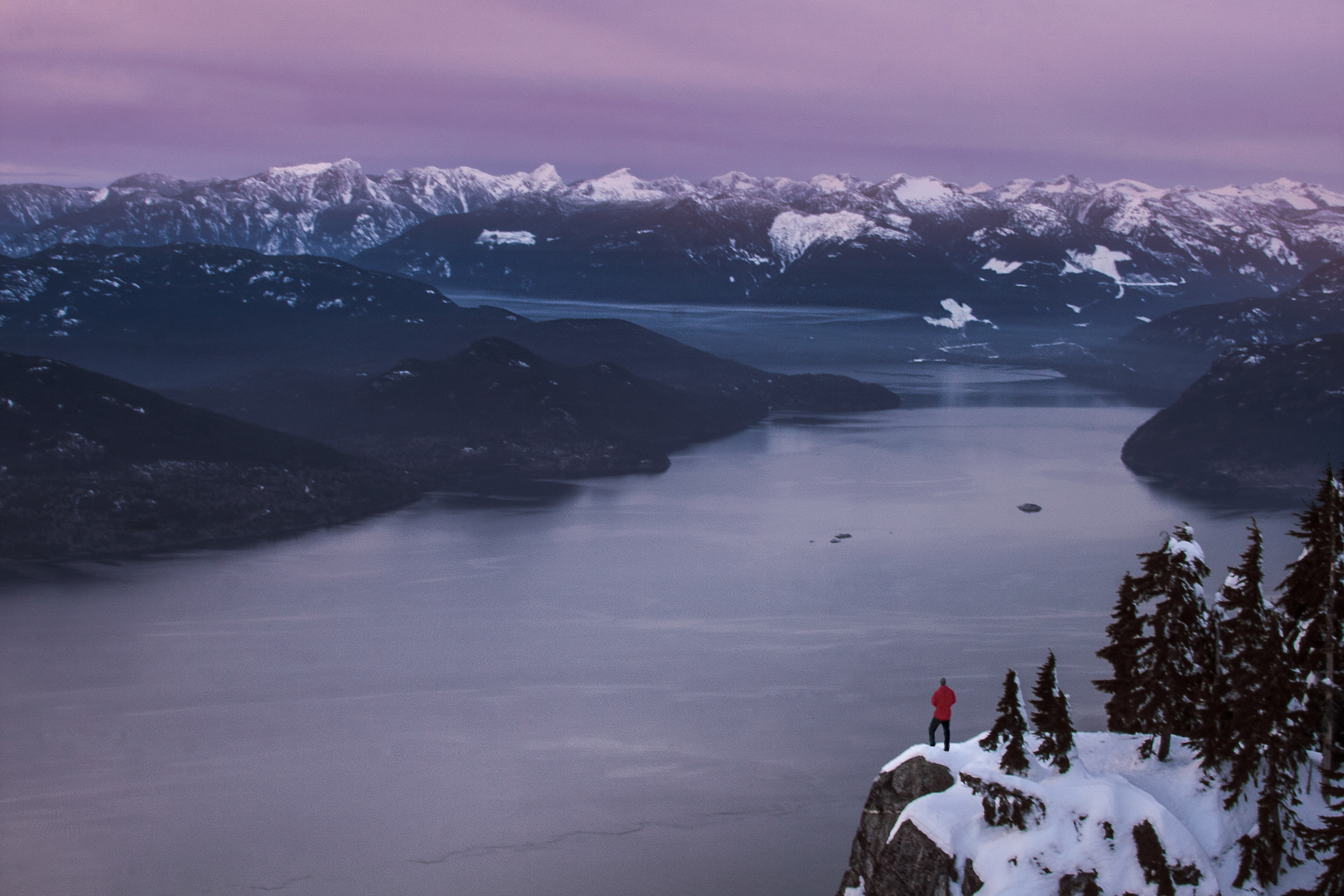
Finally, the trail will begin to exit the tree canopy and open up into usually muddy areas with a view of The Lions in the distance. Continue up the hill where you will reach a flat area with a sign marked St Mark's Summit. Head up to the left and enjoy the magnificent views of the Howe Sound. The St Mark's Viewpoint tends to be very crowded in the summer months, therefor expect a large number of people sharing the views and the trail. When ready, return to the parking lot the way you came. Do not go off trail or take shortcuts as this could lead you in the wrong direction. The St Marks Summit trail can be very dangerous throughout the winter as the steep sections are avalanche prone.
St Marks Summit Trail Map


 VIEWPOINT AT ST MARK'S SUMMIT: YES
St Mark's Summit offers one of the most stunning views of the Howe Sound and surrounding mountains such as The Lions deep within Cypress Provincial Park. There is also the Bowen Lookout closer to the trailhead accessible via an extra km or so detour on the way up.
CAMPING AT ST MARK'S SUMMIT: YES
Camping is allowed in the Cypress Provincial Park backcountry along the Howe Sound Crest Trail. No permit is required. Campers should choose locations carefully to avoid environmental damage and please leave no trace; pack it in, pack it out.
 DOG FRIENDLY AT ST MARK'S SUMMIT: YES
Dogs are allowed on-leash in Cypress Provincial Park and must be kept under control. Please pick up after your dogs and beware of the cliff sides at St Mark's Summit Lookout.
 PARKING IN CYPRESS PROVINCIAL PARK: YES
There is an abundance of parking for Cypress Provincial Park, although this very popular location can fill up entirely during peak periods, especially during the ski season. There is a designated overnight parking area for hikers heading in the backcountry on a multi day adventure. Vehicles parked overnight in the non designated areas will be towed at the vehicle owner's expense.